Florida Relief Map
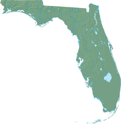
Static Florida Relief Map
Interactive Florida Relief Maps
The interactive relief map choices include a standard Google terrain map and an enhanced Google terrain map with Street View capabilities. To zoom in or out on either of these Florida maps, click or touch its plus (+) button or its minus (-) button, respectively. To pan either map in any direction, simply swipe it or drag it in that direction. To display either of these Florida terrain maps, click or touch one of the following menu options.
Florida's highest elevation is Britton Hill, which rises to 345 feet above sea level. The largest lake in Florida is Lake Okeechobee. If you are planning a visit to Florida, please see Visit Florida, the official state tourism site, where you can find a wide range of travel and vacation information. For information about Florida history and recreational activities, visit the following National Park sites.
Florida National Parks
- Big Cypress National Preserve
- Biscayne National Park
- Canaveral National Seashore
- Castillo De San Marcos National Monument
- De Soto National Memorial
- Dry Tortugas National Park
- Everglades National Park
- Fort Caroline National Memorial
- Fort Matanzas National Monument
- Gulf Islands National Seashore
- Timucuan Ecological & Historic Preserve
Copyright © 2005-2024 State-Maps.org. All rights reserved.
Florida-Map.org is a State Maps reference source.
To facilitate browsing, certain external links will open in new windows.
Florida-Map.org is a State Maps reference source.
To facilitate browsing, certain external links will open in new windows.